This time the door fell off the rig. It was not my fault. More about this later.
When last we posted, we were leaving the Gulf Coast and heading north toward Savannah, Georgia.
Savannah is as beautiful as everyone says.
We spent a few days in a hotel there to blog,
sightsee, and organize. The historic section of town oozes Southern charm. We
took a long walk through town and visited several beautiful squares surrounded
by lovely, well-maintained antebellum homes.


 |
| I have to think these aren't the only wedding photos ever shot in these gorgeous city squares in Savannah. |
On our walking tour, we visited Colonial Park Cemetery. Established around 1750, the cemetery is the final resting place for many of Savannah's earliest citizens.


While in town we saw Flannery O’Connor’s childhood home.


We had a brief tour.


We took the “Dot Bus,” because it was free.


On the Dot Bus we thad a meandering half hour trip through
the historic district. It was an interesting combination of a tourist bus, and
a bus for the homeless of Savannah.
On our last day in Savannah, we signed up for the Black
History Tour of the city. We think
Miss Monica, our tour guide, may have been on her maiden voyage as a guide.


She made up in personality and enthusiasm for what she
lacked in organization, knowledge, and mastery of facts. For instance, we found
that her take on slavery in Savannah back in the day sounded a little
implausible. On the one hand, being a slave in Savannah was no big deal.
On the other hand, it was pretty bad.
We pursued an unusual route through the city, because Miss
Monica changed her mind from time to time about the next destination, and
swerved to pursue a new idea. She delivered a nonstop commentary. It was kind of a random combination of tidbits.
Some seemed like they might be inside information about real Black History – the
kinds of inconvenient facts that aren’t covered in official information sources.
Others had more the feel of stories that Miss Monica might have been told as a child
by someone trying to scare her. Yet others seemed like the first thing that
came into her head, to fill an empty silence when she couldn’t think of what to
say.
On the plus side, Monica took us to the church where she’s a
member, the First African Baptist Church. It’s one of the oldest churches in
Georgia, founded in 1777.


When we arrived at the church there was a room full of volunteers making
up packages of food for people in need. They do this every Tuesday, 52 weeks a
year.


Miss Monica told us Africans (free and slave) built the church by
torchlight, after working in the fields all day. There is a sub floor beneath
the lower sanctuary that was a hiding place on the underground railway. "Black history isn't black
history, it's just history," Miss Monica said. “Some of the masters used to attend
services in the church -- pretending they're coming to check up. If other
whites knew they were really coming to worship, they’d be known as nigger lovers.”


Proceeding
on through town, we were told that there are tunnels in all directions under
Savannah.They were used in the underground railway, to sneak slaves to freedom
in the North.
The tour concluded at Savannah’s Black History Museum. The
most chilling exhibit was of an authentic Ku Klux Klan outfit, donated by the
granddaughter of a now-deceased KKK member.


Miss Monica pointed out that although they don’t wear the
outfits anymore, the blacks know that the KKK is alive and well. They don’t do
bonfires in public now, but they still do bonfires.....
All in all, we had a pretty good experience on Miss Monica’s
tour. Advertised as a two-hour tour, it actually lasted 3 ½ hours. So we sort
of got a bargain. We didn’t come away feeling that we had heard a cogent
presentation about Black History in Savannah, but we had met another
unforgettable personage on our journey.
After some debate, we decided our next destination after
Savannah would be Charleston, South Carolina. When we were half way there, we
made a characteristic decision to change destinations and head for Edisto Beach,
in the South Carolina lowlands near the coast. As soon as we changed course,
the rains came.
By evening, We were sitting in a campsite at Edisto Beach State Park that we were
pretty sure was beautiful, but it was raining so hard when we arrived, we
couldn't see much. Oh, and we were a little distracted by our cell phones
making a loud, grating, buzzing kind of a noise, showing the message:
"Tornado warning. Take shelter immediately." We weren’t sure where to
take shelter (later we were told the bathroom would have been a good spot), and the weather radar app on the phone indicated that the worst
of the storm would miss us, so we hunkered down in the rig and went to sleep.
Next morning, the rig and the trees seemed to be intact, so I guessed we had dodged
the bullet. We found out later that in fact two tornadoes had touched down
within a half-mile or so the night before. But the locals said “they were just little tornadoes,”
knocking down a few trees.
That
morning there were warnings of a new storm, and there were new tornado
warnings. We decided to take in some sights before afternoon, and then head
north to Charleston before the brunt of the next storm hit Edisto.
While
driving around the Edisto area, we met Shelby. A local farmer, Shelby has 27 acres under cultivation, and he
sells his produce at a makeshift roadside stand. Kate bought boiled peanuts
(delicious), and I bought local red potatoes, which we had for dinner.


While we were looking over his
vegetables, Shelby shared a few things about his life. “I put two campers
together and that makes a nice 20x35 foot space for me to live in.” “Do you
worry about tornadoes and hurricanes?” “Nope. I rode out that last one
[Hurricane Matthew, last October]. It picked up the trailer three times and set
it right down again, a ways away.” “With you in it?” “Yep.”


We drove
to Edisto beach to take a look. There was still major work underway digging out
from the damage caused by Hurricane Matthew six months earlier. Lots of heavy
equipment moving and removing debris, lots of renovations and construction
underway.


One of
our stops in the area was the Edisto Interpretive Center.


The
center has displays of local wildlife, including small aquarium units with
live, local animals on display. We arrived just in time to see the feeding of
the Atlantic stingrays and the hermit crabs.
Continuing
in the South Carolina low country, we drove out Botany Bay Road to see the
ruins of plantations where rice, cotton, and indigo were grown in pre-Civil War
days. By then the new storm had arrived, and we couldn’t get out of the rig and
walk to see the ruins up close. Also, we'd been told there were six varieties of venomous snakes in the woods on Botany Road, so we weren't eager to stroll around. But we did get a photo or two from inside the
rig.
 |
| What remains of an antebellum rice plantation mansion. |
Next we
drove about an hour north and settled in at the James Island County Park, a few
minutes outside Old Town Charleston, South Carolina.
This was
our first experience with “in season” camping on the trip. School was out in
the South; families were suddenly in the campgrounds. The campground routine changed
abruptly. Instead of quiet descending at about 8:30 each night, things stayed
active until midnight or so. Instead of silence all around, there was some kind
of noisy, modern, plastic version of horseshoes clacking outside the rig window,
the occasional cursing of a child by his parent, an endless loop of “Frozen” (a movie, for the uninitiated) emanating loudly from the adjacent rig. Walmart parking lots were suddenly
looking like the go-to choice.
In
Charleston we were tourists with a capital T. We took a bus tour of the
historic section, followed immediately by a boat tour of the harbor. In both
instances we lucked into exceptionally good guides.
Throughout
our bus tour we saw many examples of perhaps the most characteristic sight in Charleston: ornate
wrought iron gates and fences, often framing lovely gardens.


Our
guide had a somewhat jaded, wry quality in his commentary. He pointed out that
a hearing had been scheduled for that evening – someone was petitioning to
change the height limits for buildings in the historic district (nothing higher than
the tallest church steeple is allowed).


“I don’t
know why they’re bothering with this, he said” “The meeting tonight will resemble the scene from
‘Frankenstein,’ when the villagers turn out in force with their torches and
pitchforks.” Sounds like another town I’m familiar with (initials PA).
We saw
the standard Charleston sights: Rainbow Row (a series of Georgian row houses
painted pastel colors) the Battery (a historic defensive seawall populated by
stately antebellum homes), and more.
 |
| Rainbow Row. |
 |
| Homes on the Battery. |
There is
a museum devoted to the Hunley, touted as “the world’s first successful combat
submarine,” rushed into action after the losses at Gettysburg and Vicksburg. A
replica of the ship was visible on the tour; the real thing is on view in the
museum, we were told.

The Hunley sort of resembles a sewer pipe with a long lance attached to the front end. On the lance was mounted a bomb; the sub delivered it to the targeted ship. The first such attempt was successful – the Hunley sank the U.S.S. Housatonic in1864 in outer Charleston harbor. The success was short lived – the Hunley sank almost immediately afterward, taking its crew to the bottom, and wasn’t recovered until 131 years later, in 1995.

The Hunley sort of resembles a sewer pipe with a long lance attached to the front end. On the lance was mounted a bomb; the sub delivered it to the targeted ship. The first such attempt was successful – the Hunley sank the U.S.S. Housatonic in1864 in outer Charleston harbor. The success was short lived – the Hunley sank almost immediately afterward, taking its crew to the bottom, and wasn’t recovered until 131 years later, in 1995.
Charleston
of course has a history of slave trading and racial unrest, including recently the
2015 shooting at Emanual African Methodist Episcopal Church. The bus tour
driver alluded to some relevant historical events, including an abortive slave
revolt allegedly organized by a man named Denmark Vesey.
On the
boat tour we got a close-up view of Fort Sumter, and heard a description of how
President Lincoln orchestrated its defense such that the Confederacy was forced
to fire the first shot in the Civil War.
 |
| Waiting for our boat. |
 |
| Mansions on the Battery, seen from the boat. |
 |
| Fort Sumter, where it all began. |
Both of
our guides (bus and boat) told us the story of JFK’s amorous adventures while
stationed in Charleston at the beginning of World War II. Their narrations washed over us like
waves; The succession of immigrants (Scotch-Irish, Hugenots, Irish Protestants,
Hassidic Jews with Spanish surnames, Irish Catholics, Germans, Dutch), the
fires that destroyed the city five times over, the disastrous earthquake of
1886, the long and influential career of John C. Calhoun, the taking of Fort
Sumter, the destruction wrought by hurricanes Hugo and Matthew. We came away
with a mosaic impression of the history and feel of the city, but not exactly a
deep understanding. We may need to return.....
Before
we left we decided to partake of yet another tour: the Gullah Tour of
Charleston.
What’s
Gullah? The term refers to both a language and a culture developed by African
slaves imported primarily to South Carolina and Georgia. For more than 3,000
years, African rice was cultivated along Africa’s west coast, particularly in
Angola, Sierra Leone, and Gambia. When Europeans discovered in the 17th
and 18th centuries that African rice could grow in the low country
and on the Sea Islands of South Carolina and Georgia, there was a concerted
effort to import slaves who were expert in cultivating the crop to these areas .
Rice grown in the low country and on the Sea Islands became a major cash crop
for the two colonies.
 |
| Rice is still grown today in the South Carolina lowlands. |
Because
the slaves brought with them from Africa the mosquito-borne diseases malaria
and yellow fever, and because unlike the Europeans the Africans had a degree of
immunity to the diseases, the European rice planters tended to live far away from
their plantations in cities like Charleston and Savannah. So the slave
populations in the rice-growing areas were relatively isolated from European
influence in day-to-day life -- a distinct Gullah culture and language
developed and endured. Today, as many as 125,000 descendants of these slaves speak
the Gullah language, a mixture of English and several Western African tribal
languages.
The
Gullah bus tour of Charleston was conducted by Alphonse. While he covered some
of the same geographic territory as had our previous tours, Alphonse emphasized
the influence of the local black population on Charleston history. He also gave
us a dose of Gullah.
One
focus of the Gullah tour was Phillip Simmons, a revered blacksmith and artisan who
specialized in ironwork. Simmons achieved an international reputation for his work; some of his pieces are displayed in the Smithsonian.
 |
| Phillip Simmons. |
Many of
the most beautiful examples of Charleston wrought iron gates and fences were
created by Simmons during his 78-year career.
 |
| The "Heart Gate" -- One of Phillip Simmons's most famous pieces. |
Simmons’s
work has become quite valuable. “If your house has a Simmons gate and you move,
your take your Simmons gate with you.”
The
Simmons tradition is carried on today in Phillip's workshop by his nephew.


Alphonse
talked to us about the Charleston slave insurrection of 1822, the largest
planned slave revolt ever in the South. The plan failed; 131 slaves were
jailed and 37 were executed. But Alphonse pointed out that thereafter the famous Charleston ironwork at
residences began to add a new feature.
 |
| The spiky, post-insurrection look.... |
From
Charleston we moved on to visit our good friends Mary and Lindley in Asheville,
North Carolina. Mary was Kate’s longtime partner in crime when both were third grade teachers in Palo Alto. Mary and Lindley’s house is lovely and
comfortable; we were lucky to be able to spend a few days there, and to catch
up with our friends.
 |
| Mary and Lindley's home in Biltmore Forest, once owned by the Vanderbilts (the forest, not the house). |
 |
| It's rumored that the Vanderbilts once owned our rig. |
 |
| As always, Kate was very helpful and I took pictures. |
While in
Ashland we took a drive on the beautiful Blue Ridge Parkway – it reminded us
very much of the Natchez Trace Parkway.
The Blue Ridge Parkway has several scenic view areas with stunning views
of the Appalachians.


 |
| We hiked around Pisgah Lodge near the Parkway |
We also stopped
in at “Slide Rock,” a popular natural attraction in the area.
While I
was hiking near the Pisgah Lodge, my cell phone rang. I cut it off, assuming it
was a telemarketer. It rang again; I cut it off again. Then I got a text
message: "I found an iPhone in San Antonio, Texas with your business card
in the case. Do you know who it might belong to?" I phoned back to the
sender’s number and reached Vijay, the manager of a Valero station south of San
Antonio. The phone he found was locked, so all he had to go on was our
"Don and Kate Untethered" business card, stuck in the case of the phone. In the end, Vijay sent me a photo of the photos on the home screen of the lost and
found iPhone, our card, and another card in case we recognized them and could
get word to the phone’s owner that Vijay had their phone.

Nice guys still exist; Vijay went to a lot of trouble. [We tried, but couldn’t find the owner among likely suspects we had met on our travels. While searching for the iPhone owner, we were briefly in contact with Cindy, our friend from the Walmart parking lot in Oxford. Back home in Texas, she had just attended the funeral of a friend. He was the fourth of her friends to have died in the past several weeks. We think Cindy has lived a hard life. We wish her well.]

Nice guys still exist; Vijay went to a lot of trouble. [We tried, but couldn’t find the owner among likely suspects we had met on our travels. While searching for the iPhone owner, we were briefly in contact with Cindy, our friend from the Walmart parking lot in Oxford. Back home in Texas, she had just attended the funeral of a friend. He was the fourth of her friends to have died in the past several weeks. We think Cindy has lived a hard life. We wish her well.]
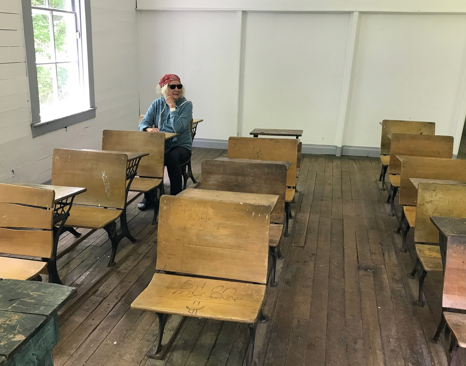
Before
we left Asheville, Mary and Lindley treated us to a tour of the River Arts
neighborhood. River Arts includes an old industrial section that’s
transitioning into a center for the arts. There is impressive graffiti there;
it reminded us of the graffiti near the P.S.1 Museum in Queens, New York City,
before it was recently removed by a sneaky condo developer.


We bade
farewell to Asheville and moved on to Great Smoky Mountains National Park, on
the border of North Carolina and Tennessee.


In
addition to its scenic beauty, the park is known for having preserved a number
of buildings and displayed them to illustrate life in the Appalachians in the
19th and early 20th centuries. A walk through preserved farm buildings from the early
1800’s impressed us with just how much work it must have been to survive and
thrive as a farmer in those days. Simply seeing all the buildings on the farm in
addition to the farmhouse gave us a graphic idea of the many arduous activities
required to live off the land in 1820 in the rugged mountain setting.


Reaching
the Cataloochee Campground in the park required navigating a long, steep, winding,
partly unpaved road.

It was worth the trip. The campground is at the heart of what was once one of the communities of farmers who settled in this part of the Appalachians almost two centuries ago. For more than 100 years (roughly 1830 -1940), white settlers took over the land from Cherokees who had hunted and fished there for thousands of years. By 1880 enough land had been clear cut that there were about 1200 acres under cultivation. In the 1920’s, as farming began to decline in the area, a campaign was started to preserve the Appalachian woodlands as a national park. Between 1925 and 1944 more than 6,500 separate tracts of land were purchased by the states of North Carolina and Tennessee. Great Smoky Mountain National Park was officially taken over by the federal government in 1940.

It was worth the trip. The campground is at the heart of what was once one of the communities of farmers who settled in this part of the Appalachians almost two centuries ago. For more than 100 years (roughly 1830 -1940), white settlers took over the land from Cherokees who had hunted and fished there for thousands of years. By 1880 enough land had been clear cut that there were about 1200 acres under cultivation. In the 1920’s, as farming began to decline in the area, a campaign was started to preserve the Appalachian woodlands as a national park. Between 1925 and 1944 more than 6,500 separate tracts of land were purchased by the states of North Carolina and Tennessee. Great Smoky Mountain National Park was officially taken over by the federal government in 1940.
The Cataloochee
campground itself is in a lovely setting; a quiet, peaceful camping area with
beautiful vistas, plentiful wildlife, and interesting buildings to explore (a
number of the settlers’ homes have been saved and preserved).


The Woody house, above, is one of the preserved historic structures at Cataloochee. It began as a one-room log cabin and was expanded around 1900 to its present size. In an oral history interview available at the information center, one of the then-children of the family recalled that as a child he once had a toothache. The local dentist told his father that if the boy and his brother caught him a mess of fish, he'd pull the tooth for free. The boys caught 202 trout in one day and delivered them to the dentist. The tooth came out.


 |
| Elk are plentiful in the area, especially at dusk. |
Our
camping neighbors at Cataloochee were Tony, his wife LaJuana, and their friends
Carmen and Jetta.


Tony has
been a freelance wildlife guide for 40 years. As the decals on their car
attest, he and LaJuana have visited dozens of national parks around the country.
They volunteer in a number of educational wildlife programs including an organization devoted to promoting camping for African Americans. At the drop of a hat they’ll pack up a U-Haul
trailer with camping gear and head off in a random direction to see what they
can see. LaJuana said “One of our best trips ever was the one when we decided
to make only left turns whenever we had a choice.” They were very friendly and gave us lots of tips on things
to see as we were heading north through Virginia and West Virginia.
Driving
north after our stay at Chataloochee, we decided to stay on the Blue Ridge Parkway as much as possible. At one
point we found ourselves in an unusual position – looking for a place to camp
with no reservation on a Friday afternoon. Usually we try to make our first day
in a campground be a weekday, so we beat the weekend crowd. On this day, we
tried calling ahead to several campgrounds, only to find that they were already
booked full. We stopped at another in person. No dice. They did tell us there
was a National Forest road not far ahead. “Just a little past mile post 352,
Turn left on the unmarked road; there may be some sites along the way.”
We found
the road. We drove, and drove, and drove.
There
were a few scattered campsites along the road, but they were all occupied. We
considered camping illegally, but forged ahead. Eventually we came to Black
Mountain Campground, operated by the U.S. Forest Service. For some reason, it
wasn’t on any of our maps, or in any of our guidebooks. It was great, and they
had vacancies! And showers! We settled into a pretty spot next to the rushing
Toe River, and stayed the weekend. Disaster averted.


A spot by the stream.
 |
| Mountain laurel on the hiking trail. |
Leaving
Black Mountain Campground, we rejoined the Blue Ridge Parkway. Before long we
were treated to a panoramic view of the Black Mountains themselves.


We
stopped overnight at the Doughty Campground on the parkway. It rained all
night, so we didn’t get a chance to hike the next day – but Kate thought it was
a cute campsite and we should get a photo.


Because
the Blue Ridge Parkway was put together by purchasing many, many parcels of
privately owned land, efforts have been made to preserve some of the parcels
and structures to illustrate historical pioneer life in mountain country. The
125 acre Brinegar Farm is an example. The farm was purchased by Martin Brinegar
for $200 in1876. Martin (21 years old) married his wife Caroline (16) in 1878,
and they built the cabin in which they raised their four children.
 |
| Martin and Caroline Brinegar. |


The
Brinegars farmed the 125 acres and raised all their own produce. They
planted flax, from which Caroline spun and wove cloth and made all the family’s
clothing. Caroline also gathered and sold medicinal plants to drug merchants to
supplement the family income. In addition to farming, Martin made shoes for the
family and custom-made and sold shoes to neighbors. He was also a justice of
the peace, notary public, and clerk of the Baptist Church.
Well
into the 20th century, many families in these mountain communities chose
to live the simple, arduous pioneer life, preferring it to the attractions of
modern city life.
Proceeding
along the Parkway from North Carolina into Virginia, we stopped in at the Blue
Ridge Music Center.


It’s a
kind of museum of the music that was the first American music – old-time,
bluegrass, and mountain gospel music. Between 1730 and 1830, waves of
land-seeking Scotch-Irish and German settlers came down the Great Wagon Road
from Pennsylvania into the Blue Ridge area. In the mountains they met English
families and Africans (both enslaved and free), moving southward and westward
from the older Tidewater settlements on the Virginia and Carolina coasts. They
brought with them a passion for religious choral music and the fiddle from
Europe and the precursor of the banjo from Africa. The result was the music of the Blue Ridge, forming the
basis for all uniquely American music that came after, including blues, jazz,
and rock and roll.
While
visiting the music center we were treated to a performance by the Buck Mountain
Band, a local group specializing in old-time music (emphasizing the fiddle –
dance music, unlike the later-developing bluegrass, which is performance
music).


Moving
on, we decided to spend a day or two in West Virginia, exploring Appalachian mountain
country. Greenbrier State Forest Campground looked like a good bet, so we set
out to find it. True to our back roads philosophy, we avoided the Interstate
and struck out on a decidedly back road route through western Virginia towns
like Fancy Gap, Hillsville, and Willis.
In
Hillsville we stopped for lunch at Aunt Bea’s BBQ (Hillsville is near Mount
Airy North Carolina, the real life town on which was based Mayberry in the Andy
Griffiths TV show).


The
walls of the restaurant were adorned with broadsides apparently depicting a
local hero, Floyd Allen. [88 photo]


Allen
was a landowner and patriarch of the Allen clan of Carroll County, Virginia. He was convicted and executed for murder in 1913. Allen
triggered the shooting at the Carroll County Courthouse in Hillsville on March 14, 1912, in which a judge, prosecutor, sheriff, and
two others were killed, and seven others were wounded. The conviction was
controversial, for very complicated reasons, and Allen is still viewed by some
today as a local folk hero.
 |
| The scene of the crime -- or was it a crime? |
After
our BBQ lunch, we walked around Hillsville and discovered the Hillsville Diner,
where we couldn’t resist the home made “cherry dump cake.” Delicious.


Hot on
the trail of Greenbrier State Forest Campground, we set the GPS and continued
on our way. We figured the trip would take us about two hours, but we were so
wrong. The route we followed, thanks to the trusty GPS, took us over at least
five or six muddy dirt roads high in the mountains, leading to several dead
ends. We passed through wooded areas with very serious looking “No Trespassing”
signs on heavily padlocked gates barring side roads. We wondered if we’d be bumping into any associates of Walter
White [in-joke for “Breaking Bad” fans]. We finally reached the GPS’s version
of the destination, and she (the GPS) announced “Your destination is on the
right. You must walk the rest of the way.” Unfortunately we were deep in mud on
a forest road with no destination in sight, just walls of thick forest on all
sides. We backtracked, and eventually found our campground – five hours after
leaving Hillsville.
This
brings to mind a cautionary tale. Practically anywhere we traveled in the rural
South and Southeast and/or in mountain country, we found that whenever we told
a ranger “Oh we’ll find it, we have GPS,” a furrowed brow and worried
expression resulted. They proceeded to give us directions anyway, in
excruciating detail we couldn’t possibly remember. They knew whereof they
worried. The GPS as often as not was completely flummoxed in these rural areas. We
would enter our destination in the device, press the appropriate button, and
find ourselves minutes or hours later somewhere not resembling our expected,
desired destination in any way. “You have arrived,” we were told, as we stared
at a dead end sign, or a road with a locked gate, or the handsome residence of
a person unknown to us, or a patch of dense, impenetrable forest. Locals told
us (as if we didn’t know) that GPS’s simply don’t work in rural areas, especially
in mountain country. We were told that even long haul big rig drivers occasionally are
led by the GPS deep into the mountains on narrow dirt roads where they get
stuck and have to recruit wreckers from distant counties to pull them out. The
moral, in case you skipped the paragraph: Beware of the GPS in rural areas.
Oh –
Greenbrier was a nice campground. We stayed for a night and moved on.
Further
on our scenic route north through West Virginia we detoured to a town called
Cass. We’d seen signs every few miles for hours, it seemed: “Cass Historic
Railroad State Park” 24 Miles, or 21 miles, or 13 miles, etc. We were
brainwashed – so we took the turnoff.
Cass was
founded in 1900 by the WV Pulp and Paper Company. Hungarian, Italian, and
Austrian immigrants built a railroad to a sawmill upriver, and Cass was built
as a company town to house the workers. The entire town and railroad have been
preserved as a state historic park.
While in
Cass we met and talked with ranger Monica and with Carmela, who staffs the soda
fountain in the Cass Company Store.
 |
| Monica & Kate. |
Monica
was born and raised in coal country near Charleston, West Virginia, and “grew
up all over the world” (her father was career army). She lives in Cass because her ex-husband worked at the
nearby radio telescope (more about this later). Asked if this (Cass area) is
now her home, she said “No way. As soon as my daughter graduates from high
school, I’ll look for a place where I can get a full time job doing what I
like.” In order to piece together a living now, Monica works at four jobs.
Interpretive ranger at the park six months a year, and teacher of online
geography courses at three local universities. She was really helpful to us,
spending more than an hour telling us about Cass’s history, and loading us up
with educational material.
Carmela
has lived in the area all her life. Her father and grandfather worked for the
railroad – everyone around worked for the lumbering operation, one way or the
other. Carmela now lives in a very
large two story house 24 miles away from her job in the company store. She
heats the house with two wood stoves, and cooks on another wood stove in her
kitchen. In winter she has to get up several times a night to stoke the fires
in the stoves. She cuts and splits all the wood herself. “It took 14 pickup trucks
full last winter.” She grows her own vegetables, carries all her drinking water
to the house from a nearby spring (the local water is "iron water, no good for
drinking”), and takes care of her mother, who lives six miles away from her and
has dementia. Kate asked Carmela if she ever thinks of living in the big city.
“No! I tried living in Winchester [population 17.000] for a few months one time. I
thought it might be good being near fast food and the Walmart – we have to drive at least an
hour to get to anything from here. Well, I only went to Walmart once or twice the whole time. I thought, what do I need this for? I moved back, and I’ve never lived
anywhere else since.” I asked Carmela if it would be OK if I took her photo
with Kate. “It would break your camera. I’m not one for photos.”
Moving
on, we took another detour of sorts (as if we had a fixed route from which to
detour) to visit the Green Bank Observatory, home of the world's
largest fully steerable radio telescope.


The telescope honors the name of the late Senator Robert C. Byrd, who represented West Virginia and who
pushed the funding of the telescope through Congress. Unlike the more familiar (to me) optical telescopes, the Green Bank Telescope (GBT) reads radio frequencies emitted from space. No need to wait for darkness; the GBT operates 24/7. Among many other scientific studies, the telescope scans for radio signals possibly emitted by extra-terrestrials.
The Green Bank Telescope sits near the heart of
the United States National Radio Quiet Zone, a unique area located in the town of Green
Bank, West Virginia, where authorities limit all radio transmissions to avoid
emissions toward the telescope. This means residents of the area can't have over-the-air television, and various quirky things involving household appliances sometimes have to be rectified to avoid corrupting telescope reception.
We took a tour of the observatory facility, narrated by a
docent.


We
honestly understood relatively little of the docent’s description of how the telescopes
work (there are actually eight telescopes at the observatory, one of which is
the large GBT). He did tell us some interesting stories
about the lengths to which they must go to keep errant radio waves from
corrupting the work of the GBT. For instance, they tracked down one such
interference source when the doorbell of one of the town residences was
shorting out. They replaced the doorbell free of charge. In another case, a farmer's electrified fence caused no problems -- until the grass grew and came into contact with the fence. The GBT gang came out and cut the grass for him.
After our tour we spent time exploring the elaborate exhibit on site at Green Bank, which was also a little
difficult for the layman (me) to understand. I was able to take a nifty radio wave
photo of myself, though.


Further
north in West Virginia we visited Seneca Rocks, rising more than 1,000 feet
above the Potomac River Valley.


The
rocks are composed of Tuscarora sandstone, originating as sea floor and pushed
into their vertical position 250 million years ago when the African and North
American continental plates collided. Water and wind erosion has worn them to a knife point along the ridge line.
The area was home to Iroquois Indians for about 10,000 years before
European-American settlers came to the valley in the late 1700’s and early
1800’s.
While at
the Seneca Rocks Interpretive Center we had a long conversation with the
resident forest historian. West Virginia
became a state toward the beginning of the Civil War, when it essentially
seceded from Virginia and joined the Union. Some of the earliest Civil War
battles were fought in what is now West Virginia, as the opposing forces tried
to gain control of important transportation routes, including roads and
railroads. Robert E. Lee lost his first battle of the war in West Virginia. He
was known then in the region as “Granny Lee,” because he moved so slowly. We
also discussed a more delicate subject: Why do many West Virginians display the
Confederate flag in front of their homes? This led to a discussion of the
recent removals of Confederate statuary in New Orleans, etc. In sum, the
historian felt that the flag displays partly connote a wistful attachment to a
romantic past, and partly represent the longstanding regional culture of
resistance to “the man,” any government encroachment on individual liberties.
During our conversation it was noted that West Virginia gave Trump the largest
percentage victory of any state in the 2016 election (roughly 68% Trump to 23%
Clinton).
Departing
West Virginia and heading back to Virginia, we stopped at a small restaurant in
a small town for lunch. One of the other customers took an interest in us and in
our travels, and as he departed, gave us a tip on the next “must see”
attractions on our route. Later when we went to pay for our lunch we found that
he had already paid for our meal. This wasn’t the first time this had happened
to us. Possibly we seem a little pathetic to the casual observer. We'll have to perfect that.
The next
stop in our wanderings was Shenandoah National Park in Virginia. The park was
the first national park east of the Mississippi, dedicated by President Franklin Roosevelt in
1935. It overlooks the beautiful, verdant, Shenandoah Valley.


We
camped at Shenandoah for a while, and among other activities we hiked to
Rapidan, the presidential retreat paid for by Herbert Hoover with his own funds.
The hike was one of those “easy” ones, about two miles downhill getting to the
destination, and about 100 miles uphill getting back.


Although
at first Hoover insisted on paying for the land and the buildings at Rapidan
completely with his own funds, he did eventually turn over the construction of
the retreat buildings to the U.S. Marine Corps. When he left the presidency he gave
the camp to the federal government to be used as a presidential retreat. His
successor, Franklin Roosevelt, found it not to his liking (the facility was
hopelessly not wheelchair accessible; FDR was wheelchair-bound), and created
another retreat, and dubbed it Shangri La. After Roosevelt’s death, it was renamed
Camp David by President Eisenhower.
Once we
had hiked to the site, we were fortunate to have the docent at Rapidan Camp all
to ourselves, and we had a lengthy tour of the remaining three (of 15 original)
buildings. The Brown House was the Hoovers’ residence while staying there.
 |
| The Brown House. |
 |
| The Brown House Living Room. |
Designed
by Hoover’s wife, Lou Henry, it was quite rustic. Hoover loved to fish for
trout. Lou Henry loved nature (she eventually became national president of the
Girl Scouts – twice). Originally she decreed that the camp would be a series of
tents on platforms. Ultimately practical considerations dictated construction
of an enclosed, but airy and rustic, group of buildings. Hoover loved to get
away to Rapidan for the weekends. He would often impatiently race to the river from
the car upon arrival, and begin trout fishing in his three piece suit.
 |
| Trout Fishing in full dress. |
We also
visited the Prime Minister’s House, once occupied by British Prime Minister
Ramsay MacDonald during meetings with President Hoover. The house is now used
as a museum.


 |
| The outdoor fireplace, where Hoover would pose with visiting dignitaries. |
In the
course of our tour we learned much about Hoover that we hadn’t known. He was
orphaned at the age of 10, eventually was sponsored by an uncle to attend
Stanford where he studied engineering, became a brilliant mining engineer and
by the time he was 28 he was declared the man under 30 with the highest salary
in the world ($33,000 annually), working as a mining engineering consultant
with companies worldwide.
Having amassed
a considerable fortune, during World War I he became a peripatetic
philanthropist, and was later recruited into public service as Commerce Secretary
under Calvin Coolidge. Hoover became wildly popular and well known as Commerce
Secretary.
 |
| Political cartoon depicting Hoover as "Secretary of Everything Else." |
When
Coolidge decided not to run for a second term, Hoover ran and was elected
president in a landslide.
Our
travels have been educational, and have impressed me repeatedly with just how
ignorant I am. I’ve always had Hoover pigeonholed as a one-dimensional
character (something like: “Presided over the beginning of the Great Depression
and refused to do anything about it.”).
Likewise, I’ve always thought of Robert Byrd as: “Racist conservative
Southern senator”. On our travels we learned that Byrd was a key force in
securing federal auspices and funding for the Green Bank Observatory, and for
Shenandoah National Park. Hoover was a self-made Wonder Boy, a philanthropist
and humanitarian, a visionary public servant, and an avid sportsman. Apparently,
things are more complicated than I give them credit for.
Moving
north, we spent most of one day at Harper’s Ferry, West Virginia.


 |
| Harper's Ferry is at the confluence of the Shenandoah and Potomac rivers. |
Harper’s Ferry was
historically important in many ways.
In 1803,
Harper’s Ferry was a staging area where Meriwether Lewis obtained arms and supplies for his then upcoming expedition with William Clark . It was here also that Lewis designed,
built, and tested the boat that he hoped would carry the explorers to the
Pacific.
 |
| A replica of the frame of Lewis’s boat. |
 |
| Unfortunately, in the wild the boat proved unseaworthy and ultimately was buried along the banks of the Missouri. |
Positioned
where there was abundant timber, lime, iron ore, and water power, Harper’s
Ferry became a key manufacturing center and transportation hub in the early
1800’s. Because of availability of key natural resources needed for the
manufacture of guns, it became the site of one of only two U.S. armories. When
the railroads came in the 1850’s, Harper’s Ferry was a key destination on the
tracks connecting the east to the expanding frontier to the west.
 |
| Harper’s Ferry in the 1850’s. |
Harper’s
Ferry became a focal point for the abolitionist movement when John Brown
decided in 1859, with a force of 22 soldiers, to capture the U.S. Armory, arm
the slaves, and lead a rebellion to free the slaves of the South. Brown’s
attack was a flop, and Brown was hanged in short order. But it became a
rallying point for abolitionist sentiment, and hastened the inevitable start of
the Civil War.
 |
| "We can weigh John Brown’s body well enough, but how and in what balance weigh John Brown." Steven Vincent Benet, John Brown’s Body. |
As the
site of an armory, an important transportation hub, and a manufacturing center,
Harrper’s Ferry was important strategically to both sides in the Civil War.
Battles were fought and control of the city changed hands no fewer than eight
times during the course of the war. In one of these battles, Thomas Jonathan Jackson
acquired the moniker “Stonewall Jackson.”
 |
| General Thomas "Stonewall" Jackson |
After
the Civil War, all-black Storer College was founded at Harpers’s Ferrry, housed
partly in the former homes of armory employees. Storer became an important
symbolic location for gatherings of early civil rights leaders, including W.E.B. DuBois.


Leaving
Harper’s Ferry, we had another in a long line of interesting rig experiences.
Attempting to close our large (4 feet by 6 feet) sliding door, we pulled on it
too hard (I guess) and the whole door fell off, except hanging on by one slim
hinge/wheel. We were pretty sure we were in for major delays while we hunted down a
sliding door repair expert somewhere in rural West Virginia. Instead, we
somehow heaved it into place and popped it onto its tracks – and it worked! We’ve
treated it with kid gloves since, and so far it’s still with us.
 |
| The door. Intact. |
Heading
north and east now, we stopped overnight at the Owens Creek campground in Catoctin
Mountain National Park. Literally next door to us was Camp David, vacation
retreat of every president since Franklin Roosevelt (except Donald Trump).
On to
Gettysburg National Military Park.


At
Gettysburg we saw an excellent introductory film narrated by Morgan Freeman,
describing the issues resulting in the Civil War in general, and describing the
battle at Gettysburg in particular. We then viewed an enormous 360 degree cyclorama
painting of the Battle of Gettysburg, painted in 1880.
 |
| A still from the introductory movie. |
 |
| Viewing the cyclorama. |
 |
| Cyclorama painting detail. |
The
Battle of Gettysburg took place essentially at the same time as the Battle of
Vicksburg – they ended in Union victories one day apart in July of 1863.
Between them, they constituted the turning point of the war. Although the war
continued for another two years, the South never recovered from these two
defeats.
After
seeing the film and the painting, we followed up with a bus tour of the
Gettysburg battleground with a not-so-great tour guide. When we reached the Virginia
monument on the battleground there was a ceremony under way: “The Army of
Northern Virginia” was celebrating the hundredth anniversary of the placement
of the Virginia monument, a statue of Robert E. Lee astride his horse, Traveler.
 |
| Virginia Monument at Gettysburg. |
The Army
of Northern Virginia was the army based in Virginia under the command of Robert
E. Lee. There seems to be modern day group identified as The Army of Northern
Virginia as well. Among the assembled participants there were many people
wearing the uniform of the present day group – a jacket festooned with sewed-on
badges depicting Confederate flags and other, more mysterious symbols. There
were speeches tinged with nostalgia for the days when men were men, women were
women, and slaves were slaves. There were many, many Confederate flags in
evidence in the crowd.


Our
guide was a real Civil War buff. Or at least a Battle of Gettysburg buff. He
loved describing, in addition to the battle strategy, just how the soldiers
went about killing each other. He was especially keyed up about guns and
canons, and several times urged all of us on the tour to go to the museum and
view the long range rifle with a scope that could kill a man a mile away (We
went to the museum afterward, but I couldn’t find it.).


Speaking
for myself, I’m just as glad to put the Civil War sites behind me. I guess I
felt obligated to visit the ones that were ranged in our path, but the experience
gave me little pleasure. The commentary on the battlefields ran to excited
expositions about how one general outsmarted another, how many people died, and
how they got killed. It seemed
like a cheerful game, described in detail like a Super Bowl contest from
years ago — except thousands of winners and losers wound up dead. Just not my
thing, I guess.
It
occurred to us that Gettysburg was not far from Philadelphia. Coincidentally
Bill and Andrea, our good friends from Palo Alto, were currently visiting their
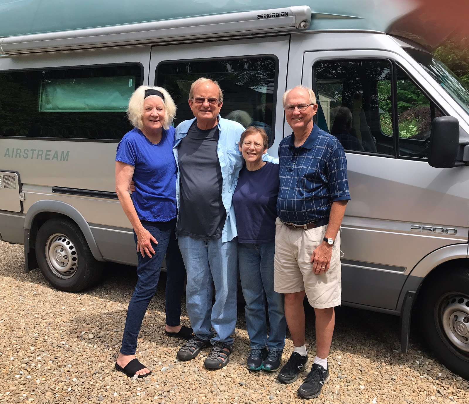
daughter Lindsey and her husband Danny in Philly. So off we went to Philadelphia. We had a short but sweet visit.
Lindsey and Danny live in a great downtown neighborhood with their two kids,
Winslow and Mieke. They had a full house so Kate and I slept in the rig in
front of the neighborhood school. We
went to a laundromat in Little Italy, and had some great coffee in a place that
reminded us of North Beach in San Francisco.


We all
had lunch at the Barnes Foundation art museum and had a good meal and a lot of
laughs.
 |
| Andrea, Kate, & Bill. |
 |
| Winslow, Andrea, Kate, Mieke, & Lindsey. |
 |
| Don, Danny, & Bill. |
On the
move toward the north again, we stopped for a while in Woodstock, New York.
Pursuing one of the many themes of our travels, we checked out the local
bookstore, “The Golden Notebook.”
Terrific. The shop was featured in the book “Footnotes from the World’s
Greatest Bookstores,” and for good reason. We had fun talking with owners
Jackie and James.
 |
| Kate at the Golden Notebook. |
 |
| Kate and Golden Notebook owners Jackie and James. |
 |
| 70's Guy at Woodstock. |
Later,
in Albany, New York, we visited with grandson Nathan. The three of us watched
the Warriors win the championship at an Albany sports bar. Nathan caught us up
on his exciting new life in New York – he’s already the top regional salesman
for GNC!
 |
| With Nathan at Andy's Place Sports Bar, in Albany |
While in
upstate New York we visited family friend Zeke and his wife Adena, in
Greenville. Zeke and Adina are helping manage a complicated family business in
a rural setting. Greenville Arms was built in1889 and is now operated as a bed
and breakfast inn, but much more. It also houses the Hudson River Art Workshops
program and Life by Chocolate, an artisan chocolates and confection boutique.
There’s a lot going on there! Zeke prepared a delicious breakfast for us, and
we had a good time catching up.
 |
| The Greenville Arms. |
 |
| Candies galore. |
 |
| Don, Kate, Adina, & Zeke. |
Next
stop: the Boston area.
Miles to date: 19,393
States:
California, Oregon, Washington, Montana, Idaho, Arizona, New Mexico, Texas,
Arkansas, Missouri, Illinois, Kentucky, Tennessee, Mississippi, Louisiana,
Alabama, Florida, Georgia, South Carolina, North Carolina, Virginia, West
Virginia, Maryland, Pennsylvania, New Jersey,
New York (26)
New York (26)
Countries:
U.S.A., Canada, Mexico (3)

