When last I posted, we were finishing up our stay in Dallas after seeing the Women's Final Four.
Before leaving Dallas we decided to do a little
sightseeing. For our few days in
town, the city impressed us as clean, prosperous, friendly, and in many ways
beautiful. It has several tall, elegantly designed glass-and-steel skyscrapers,
with some very inviting, green mini-parks scattered among them.

We decided to visit Dealy Plaza. We had a shared ambivalence about it. On the one
hand, how can anyone of our age and political persuasion spend time in Dallas
without eye-witnessing the site where JFK’s life ended? On the other hand,
there’s a curiously unhealed wound, 54 years later – why disturb it? At any
rate, after we had packed up, checked out of the hotel, put way all our stuff
in the rig, we walked a mile or so to the Dealy Plaza area.
Ignoring the fact that most people who live in Dallas
weren’t even alive in 1963, I have a nagging sense that the entire city will
forever be guilty of having killed my president. Our visit to the place where
he was killed didn’t notably moderate this feeling. We started at the austere,
simple memorial to JFK, erected by the citizens of Dallas.

The plaques surrounding it stress the exciting joy that
was his life, not the tragedy of his death (but there they were, acknowledging
the tragedy of his death). We walked on to the Plaza itself.

It’s strewn with signs pointing out where Zapruder stood
with his movie camera, where the exact point of entry of the fatal shot
occurred in the middle of the street, exactly where the grassy knoll is located
and what happened there, etc.
There were people hawking copies of the Dallas Times the day after (I
bought one for 5 dollars – what will I ever do with it but throw it away, as I did my November 1963 copy of Life Magazine?).

Dallas Morning News, grassy knoll in background.
There were other hucksters selling “absolute proof” photo
brochures, showing that there was a second gunman on the grassy knoll. Looking
up at the Texas School Book Depository, we could see that all the windows had
shades pulled except the one from which the fatal shot was fired. That window
revealed cardboard boxes stacked presumably as they were when
Lee Harvey Oswald was doing his worst, to brace the rifle.

We decided we didn’t need to extend the pain by actually
going to the “Sixth Floor Museum.” There’s something uncomfortable about Dallas
profiting from the grim curiosity of endless generations about the sensational
killing that day.

Driving east across Texas, we knew we were leaving the
desert at last. Lots of green grass and green trees, lots of water.

Also lots of religion. We weren’t more than an hour outside
of Dallas before we were greeted with the roadside sign: “Jesus welcomes you to
Fruitvale.”
We spent the night at the Walmart in Mineola, Texas. I’ve formed
a new attitude about Walmart. Well, not exactly a new attitude; maybe it’s an additional attitude. I
still harbor liberal resentment about their low wages and inadequate personnel
policies, to be sure. But now I have a separate, independent, positive
Walmart attachment. Good old reliable Walmart. It’s always there, shining out
at us 24 hours a day no matter where we’ve landed, with cheap food that’s
always the same, stocked in the same place, easy to find in the familiar floor
plan. And in most cases they throw in a free place to spend the night (back
section of the parking lot, near the gas station), and a bathroom to use for an
early morning sponge bath and a shave. There’s a lot to like.

Shroud enjoys the morning air in the Walmart parking lot.
On we went to Kilgore, Texas. Kilgore is a BIG oil city, or
at least it was very big in the 1930’s and for the next several decades.

Kilgore is at the heart of the huge East Texas Oil Field,
discovered in 1930, at the time the largest oil field in the world. At its peak
the field sported 32,000 producing wells. In the nearly 100 years since 1930,
the field has produced six billion barrels of oil, and will produce another
billion before it’s sucked dry. Kilgore is also the town where Van Clyburn grew
up and learned to play the piano. Go figure.

World's Richest Acre Park in downtown Kilgore, where the greatest concentration of oil wells in the world once stood.
We visited Kilgore College, home of the East Texas Oil
Museum and of the Rangerettes Museum.

At the Oil Museum we learned a lot about how oil is
discovered, recovered, and utilized, and why it’s of benefit to each and every
one of us in the USA. We learned that The East Texas Oil Field produced more
oil during World War II than the Axis powers combined. We saw a film about the
oil boom in the 1930’s and we took a simulated ride down a drill shaft to the
sandstone layer 3,650 feet down that is the source of Kilgore oil.
At the Rangerettes Museum we learned much about the very
first dance and cheer group ever assembled in the world. We viewed a film
devoted to the history of the group, and learned that since its inception at
Kilgore College it had generated a multi-billion dollar worldwide industry
centered around dance and cheer groups who mainly provide entertainment during
intermission at sports contests.

We stopped in Jefferson, home of the Excelsior Hotel – a
favorite of Ulysses S. Grant and of Lady Bird Johnson.

While in Jefferson we toured the luxury rail car of Jay Gould.
Seemed like a good fit to me…..

We also visited Jefferson’s General Store.

On that very day, we had a shroud breakthrough! We heard from Bruce, one of the other 266 living owners of a 2005
Westfalia/Mercedes/Dodge/Airstream motor home. He replaced his air conditioner
with another brand, and God knows why, but he had kept his old shroud (like the
one that blew off our rig) and offered it to us for free! It’s being shipped to
us at the home of our friends the Mahons in Brookline, Massachusetts (near
Boston), where we expect to arrive sometime in late May or early June. Now if
only we can find someone near Boston with the skill and availability to install
the new (used) shroud, reinforced so it won’t blow away again.
Moving on, we camped at the Alley Creek campground outside
of Jefferson. Beautiful setting, nice sunset. Just a brief way station on our
way out of Texas.

Passing through and leaving East Texas. Some random sights
along the road:


They say Texas is a big state; now we have a new, personal
appreciation of that fact. We entered the state on March 20, with the intention of
getting through and out of Texas as quickly as possible. We crossed the line
into Arkansas on April 5. Sixteen days to cross one state as quickly as
possible. It’s not only big, it compels you to stay a while, one way or the
other.
We had places to go and people to see, but first we wanted
to take a look at Hot Springs National Park in (duh) Hot Springs,
Arkansas.
On our way to Hot Springs Kate kept saying, annoyingly (sometimes
she can be so annoying), “Are you sure you put the right destination
in the GPS? There aren’t any signs saying we’re getting near a national park.”
Finally I huffed, “If you don’t believe it, pull over and put it in the GPS yourself.”
She did. Same result.
Miraculously, we arrived at the park campground as promised
by the GPS. It’s lovely. In the woods, by a stream, flowering dogwoods here and
there.


Once we settled in, we went to find the park information
center. When we found it, we realized the cause of our confusion. Like Eastern
Cascades National Park, this park conformed not at all to our expectations of
what a national park is. The information center is actually in the city of Hot Springs. The center occupies the building that
formerly housed the Fordyce Bathhouse, on a street lined with old bathhouses
from days gone by.


The park is unique: Campsites and trails in low-lying
mountains, closely surrounding and incorporating a small city built around 47 hot
springs. The hot springs themselves have been in this area for thousands of
years. Indigenous tribes took advantage of the health-giving effects of the 143-degree
mineral waters as least as far back as the 1700’s, and probably long before.
After the Louisiana Purchase in 1803, more and more people came to the area to
soak in the waters. In the early 1900’s the existing crude bathhouses were
replaced by grand, palatial versions along “bathhouse row.” Hot Springs became
a popular destination for the wealthy to “take the waters,” as if in posh European
spas.

In the 1920’s and 30’s, Hot Springs had quite a reputation
as a wild and woolly place. It was frequented by gangsters from Chicago and
NewYork, including Al Capone and Lucky Luciano. It’s said that during
Prohibition, the liquor didn’t stop flowing for a minute in Hot Springs.
In the city of Hot Springs we strolled through bathhouse row
– all but two of the opulent bathhouses are now converted to other uses. We
dropped by the visitor center and stopped in for happy hour at the Superior
Bathhouse Brewery (formerly the Superior Bathhouse), that advertises “Hot
Springs on Tap” -- all the in-house microbrews are made using mineral water
from the springs.

Southern black-eyed pea hummus.

Madden's No 1. "It's the Water."
At the visitor center we met Erin, the current Artist in
Residence at the park. She’s a painter from Monterey, California, specializing
in botanical illustration, and was managing to fulfill her responsibilities
with two children in tow (and a husband to help).

Erin, et al.
We also toured the still-preserved bathhouse facilities in
the visitor center, including “hydrotherapy” contraptions that people would sit
in for treatments, with just their heads sticking out, electrotherapy devices,
and ahead-of-their-time weight lifting machines.

On one of our days in Hot Springs we hiked several miles
into town from the campground. The beautiful, lush, green woods were quite a
contrast after having spent almost two months in the desert.


If you look closely, you can see our rig
We took a break to check out the Hot Springs Mountain Tower.
The view from the top encompassed the entire town of Hot Springs and part of
the park.


In town that day we decided to find out about the Arkansas Career
Training Institute. The Institute is housed in an enormous building that towers
above bathhouse row, built by the CCC during the Depression years, like many
other national park buildings and trails we’ve seen.


We were lucky to have a private tour from Nancy, who
identified herself as “The administrative assistant of the assistant
administrator.” We identified her as an attentive, expert person who is very
enthusiastic about the mission of the Institute, and who was cordial, friendly,
and very patient in addressing the million or so questions we threw at her.

Nancy has worked at the Institute for fifteen years, and
knows a lot about the history of the building and about the current
mission of the Institute. The building was constructed in1933; it originally
housed an Army-Navy hospital. Sold by the federal government to the state of
Arkansas ($1.00) in1960, it has been through a few iterations before becoming a
facility to offer job training to disabled Arkansans. The building recently was
added to the National Historic Register, and the interior has been maintained
to preserve its original elegance.


The institute now offers a number of job training programs
(computer science, welding, culinary arts, etc.) to Arkansans with a wide
variety of physical, emotional, and mental disabilities. About 250 students are
in residence at any one time; more than 30,000 have completed the program in
the 56 years since it opened its doors. Tuition is free, and includes three
meals a day in the cafeteria, free laundry access, and many other services.
We were really impressed with the building, with the
Institute program, and with Nancy. And, she gave us free meal tickets for the institute cafeteria.
After a big day like that, the thought of an arduous hike
back to the campsite was a downer. Luckily, Uber has arrived in Hot Springs,
Arkansas – so we got a ride home in a Chevy pickup.
Next morning bright and early, back to the rehab institute
for a great breakfast with the students. Eggs, bacon, sausage, toast with jam,
coffee, and grits. Another terrific (and unexpected) experience!

Next we had another Hot Springs-only experience. We went for
a Deluxe Bathing Package (on sale for $79), including whirlpool mineral bath,
logoid loofa mitt, sitz bath, sauna, 360 degree needle shower, full body
steamed towels, cool down, Swedish massage, and hot paraffin wax hand
treatment. All this was delivered at the Buckstaff Bathhouse, operating
continuously since 1912 – seemingly with a lot of the original equipment.
Services were segregated; I went to the first floor men’s area, Kate to the
second floor ladies’ area. We both emerged after a couple of hours
really relaxed.

My masseuse was Ron, a ceramics engineer from Kansas City.
Ron had worked previously for a semiconductor company in K.C. He moved to Hot
Springs about seven years ago, studied massage and became licensed, and has
been working at Buckstaff ever since.

Ron told me that since Buckstaff is within the boundaries of
the National Park, it’s regulated by the U.S. Department of the Interior.
Maximum water temperatures, length of sauna treatments, etc., are all prescribed,
and periodically an undercover agent comes for a Deluxe Bathing Package to
check up on them. I’m seriously considering a new career as a USDI undercover
bathhouse investigator.
From Hot Springs we took a day trip to Little Rock. Our
first stop there was Central High School, integrated in 1957 by the Little Rock
Nine, and still in operation today as a fully integrated public school. Central
High is not only a high school, but is now a National Historic Site.

We toured the school in the early afternoon with Ranger
Toni, a graduate of Mississippi State (Go Bulldogs!) Toni did an internship
with the National Park Service while in college, and landed a full time ranger
job through the Pathways Program, like several other rangers we’ve met on our
travels. I have to say, Toni was
fantastic. I can’t imagine a better guide for the fifth grade group we sneaked
into for the tour.

For those of us who are of an age, the strife at Central High
left an indelible image from watching in real time the angry mobs, the brave
children, Governor Faubus, President Eisenhower, and the armed paratroopers on
our black and white TVs. It was startlingly upsetting to see it all displayed
again, to see the actual site of the events, and to hear about it from such an
eloquent guide as Ranger Toni.


The Mobil Station was the place where 100 reporters from around the country and the world assembled across the street from the high school
Our last visit in Little Rock was at the Clinton
Presidential Library.

It’s a beautiful buiilding in a lovely setting, on the banks
of the Arkansas River. The exhibits were a sometimes sweet, sometimes painful
reminder of what a president can be. As I sat in the replicated Clinton Oval
Office, I found myself contemplating a run in 2020 (when I’ll be only a year
older than Bernie is now). I feel we need a psychologist in the Oval Office.


From Hot Springs we drove the back roads north to
Fayetteville to visit our friends Lisa and Tom, and their kids Lindy and
Tommy.


Peggy, our friend for more than 50 years (and also Lisa’s
stepmother), was visiting them at the time, helping out while Tom recovered
from back surgery. Fayetteville is a large city of over 200,000, and home to
the University of Arkansas Razorbacks (“Come pig, Soooeee!). It made for quite
a contrast with the string of small towns in Texas we’d been frequenting. Quite
cosmopolitan, very Blue (as opposed to Red), and altogether seeming a good
place to live.
We camped more or less in the middle of the street in front
of Lisa and Tom’s house. The neighbors didn’t seem to mind, or even notice.


The shroud lived under the rig.
During our visit Lisa took us for a ride to see the sights
of Fayetteville, thereby setting the modern record for the longest and most aimless
drive around Fayetteville. To be fair, we were talking nonstop and laughing too
much most of the time to notice where we were going.


Kate and Lisa at the stadium (Home of the Razorbacks).

Don and Lisa on campus.
On our last evening in Fayetteville, five of us went out to
dinner and Tom and Tommy held down the fort at home.


We really enjoyed our stay – we expect to return sometime soon.

Lisa, Kate, Peggy, Don, and Lindy.

Tommy and Tom.
We really enjoyed our stay – we expect to return sometime soon.
Leaving Fayetteville, we took so many back roads that after
a while we had no clue where we were, Our trajectory was in any case through
the Ozarks, along the Trail of Tears where the Cherokee, Osage, and Cheyenne
were driven from Mississippi and North Carolina to Oklahoma, at the behest of
Andrew Jackson. Tall mountains, deep valleys, steep winding roads, lush
landscapes, cattle pastures, old barns, the Buffalo River, herds of elk.


This area of the Ozarks satisfied our wish to be on the back
roads beyond our wildest imaginations. There were many roads, and seemingly all of
them were back roads – one more back than the next. {photo: not recommended for
buses or RVs] One of our destinations was Lost Valley. Aptly named.


We took one of those guaranteed “easy” hikes, entailing
climbing 100 or so stone stair steps into a gorge to a waterfall. The scenery
along the way was great


On the other hand, it was a little damp on the way back to
the rig.
After we wrung out our clothes, we searched out a Lost Valley
campground for the night.


Upon investigation, we found that Lost Valley wasn’t so lost
after all. The gorgeous stone house across from our campground (where we were
the only campers) was “the Clinton house,” owned by Bill’s first cousin Roy.
The general store is “historic;” the people who run it were the most helpful,
generous people you’d ever want to meet.


We were told that practically everyone who lives in the area
is part Native American, a consequence of the Trail of Tears connection.
Eleisha, one of the general store staff, is descended from Osage and Cheyenne
tribes, and has a family album showing the original general store and the early
zinc and lead mining in the area (one of the miners was her great grandfather).


Eleisha and Kate.

Eleisha's great grandfather is the second from the left.
Even the renters were great. Adjacent to our campground,
staying in a rental cabin were two couples from Minnesota, traveling together.
They (or at least one couple) had sold their house and were traveling by car on
the back roads – sound familiar?


The Minnesotans.
We had long conversations with the Minnesotans; they’re avid
canoers, hikers, and cross country skiers. One of the couples had had a Don and
Kate-esque road experience. They left their truck and went for a long hike.
When they returned, mice had chewed through sparkplug wires and with the
remaining three functioning cylinders they barely were able to climb the hill
to reach their next destination. Among other things, we talked with them about
Minnesota and Minnesotans. One of the fellows summed up: “We’re very nice.”
While in the Ozarks we stopped in Jasper. We tried Emma’s
Museum of Junk, but Emma hadn’t shown up for her 10 am opening by 1 pm, so we
gave up and had lunch nearby at the Ozark Café.


The Ozark Cafe
has been serving meals continuously for 109 years. It’s rated one of the top 50
restaurants in the U.S. for foodies by New York Magazine and as the best place
for breakfast in Arkansas by the Arkansas Times. We had chocolate malts and an
Ozark club sandwich (made with lots of bacon and American cheese and Ozark
sauce, among other things). Delicious.
On our way, we spent the night at Tyler Bend Campground on
the Buffalo National River (the Buffalo was the first designated national river in the
U.S.). Beautiful setting, nice butterflies.


Late that afternoon, Kate discovered that her very valuable
sandal was missing. It was part of a pair she had been trying to find for
months, and had finally tracked down and purchased in Dallas, only a week or so
ago. Avid and devoted readers of the blog (if any) will realize that once Kate
discovers something is missing, no stone is left unturned in attempting to
recover it (See: fresh water cap - Missoula, and shroud search - Texas and New Mexico and Texas). We called and left a message at the Lost Valley General Store. We
retraced our steps to everywhere nearby where we thought it might have been
lost. We even phoned the Ozark Café and talked them into checking the gutter across
the street from the restaurant. No luck.
Hope seemed lost when the next morning we packed up and
readied ourselves for the “easy” Buffalo River Outlook Trail hike. We stopped at the visitor center at the
trailhead, and during our conversation with Ranger Terry, Kate mentioned she
had lost her shoe. Terry was thunderstruck. “I saw a shoe this morning at the
post office in St. Joe.”


Kate and Ranger Terry.
That was all it took. Off we raced, ten miles down the road
to St. Joe, population 132. We
checked with the postmistress and indeed, the shoe was there.


It developed that Ranger Terry only stops at the post office
once every few months. That day happened to be the day. The shoe was lost, and
now was found. Amazing grace.
Kate had a spring in her step as we started hiking the
“easy” hike. Soon I had premonitions about just how easy it was going to be.


The trail became steep.


Kate pursued her interests in wildflowers and fossils.


I pursued my interests in hazardous cliffs, panoramic views,
and aged, preserved homesteads


Toward hike’s end, we encountered another hiker coming
toward us. “Glad to see you both have two shoes on.” The lost shoe story was
already spreading far and wide through the Ozarks. We’re part of local
folklore.
The hike completed, we set out to get up close and personal
with the Buffalo River. We hired a canoe and began our passage down the river,
through treacherous rapids (not). What a wonderful river. The Buffalo was the
first “National River,” named as such in 1972 after a long battle to keep
Congress and the Army Corps of Engineers from damming it. A key turning point
was when Gov. Orville Faubus wrote an impassioned letter to the Corps of
Engineers pleading to preserve the river as it was. Ultimately it was named a
National River in a bill passed by Congress and signed by Richard Nixon. Are
there no pure villains?
On our canoe trip we had a relaxing time, viewing turtles on
the shore, an eagle overhead, and the lazy river itself.


Don, Kate, and Don's Thumb.

From the Interesting bits of information gleaned on the fly
Department:
Ranger Terry: "In the South, we're
not much into daheting. If you cain't frah it, it's probably not gonna be
eaten."
Traveler who had just passed through Memphis: “I
asked this guy how to find Graceland, and he said ‘It’s just a mile down the
road; you can park in back. Are you armed?’ It’s not in a very good
neighborhood.”
Further into Arkansas.
Our next interim destination turned out to be
Bull Shoals White River State Park, in Bull Shoals, Arkansas, recommended by
our friend Tom in Fayetteville. Yet another unbelievably gorgeous place (is
this getting tiresome yet?). This is the most popular campground in Arkansas.
We didn't have a reservation and they were full, but they gave us a very
private site right on the river (don't ask me why). Many Great Blue herons
flying around and fishing, right in our front yard.


Being an expert fisherman, I decided to go out
on the river with a guide to give him a few pointers. My guide was Rick, who
has been a guide on the White River for 30 years.


Rick, my guide.
In case it’s not completely legible in the
photo, I’ll confirm that “Certified Master Baiter” is printed on Rick’s
t-shirt. Among other things, I was
able to show Rick how to cast straight down under the boat, and how to tangle
the line around the reel to the extent that a backup pole and reel were put
into action. Rick was able to show me how to untangle a hopelessly tangled
line, how to bait the hook with worms, or corn, or shrimp, or various
combinations depending on the situation. I felt it was a fair trade. The river was calm and misty in the
early morning.


Between casts we spotted a baby bald eagle in
its nest.


Thanks to my expertise and skill, I caught
enough rainbow trout to supply us with dinner that night.


We needed to extend our stay in order to have
the rig serviced, so we took advantage of the extra time by canoeing down the
White River. We decided to paddle
11 miles – about five times farther than we had done on the Buffalo. By now we felt –
what can I say? – expert at canoeing on rivers.
While we paddled along I saw something I
wanted to photograph – a little reminder that we were in Trump country -- so I pulled
my phone out of my pocket and snapped a quick shot.


As I replaced the phone in my pocket I noticed
the paddle slipping off my lap into the river. Thinking quickly, I reached out
to retrieve it before it got away. This caused me to plunge into the roiling
waters, pulling the canoe with me. Since Kate also had been a canoe occupant,
she joined me in the river. The canoe went upside down. We tried to drag it
ashore (we were in the shallows). The canoe responded to our efforts by filling
completely with water. We got it to shore and began dragging it onto dry land
(dry rocks, actually). Curiously the previously light weigh craft now weighed
somewhere close to a million pounds. Tugging and pulling and tipping,
eventually we removed our vessel from the river and emptied it of water. In the process, my phone was dunked in
the river along with both our sets of electronic car keys. As we re-entered the canoe, I realized
that things looked a little fuzzy. Concussion? Stroke? No, but my glasses were
missing. Somewhere at the bottom of the river, I surmise. Kate immediately had
a plan. We should rent diving masks and return to search for my glasses. More
on this later.


Thinking quickly, I
grabbed my (apparently undamaged) phone and got a photo of Kate, just after we
had rid ourselves of the unwanted ballast.
We continued on our paddling way, fighting a
pretty strong headwind. It reminded me of one of those algebra problems: “The
river is flowing at a rate of three miles per hour. Don and Kate are paddling
with the current, into a headwind of ten miles per hour. If it takes Don and
Kate four hours to travel 11 miles, how much arthritis pain will Don suffer?””
We were consulting a map that had been
provided, indicating landmarks along the river, and identifying the place where
we were supposed to end the journey and get a ride back to the campground.

The map had labels like “Partee Shoal,” and “The Narrows,” with our destination identified as “Wildcat.” Unfortunately there were no handy signs posted along the shore letting us know “Here you are at Partee Shoal,” or “Welcome to The Narrows.” Eventually we asked a fisherman on the river if he knew where the Narrows were. “Just down the river there, that’s the start of the Narrows.” We looked where he was pointing and saw…..more river. Still uncertain, we charged ahead and by some miracle eventually found “Wildcat” (unlabeled), and made it home. The phone worked fine, the rig keys worked fine – and I had a spare pair of glasses. No harm, no foul.

The map had labels like “Partee Shoal,” and “The Narrows,” with our destination identified as “Wildcat.” Unfortunately there were no handy signs posted along the shore letting us know “Here you are at Partee Shoal,” or “Welcome to The Narrows.” Eventually we asked a fisherman on the river if he knew where the Narrows were. “Just down the river there, that’s the start of the Narrows.” We looked where he was pointing and saw…..more river. Still uncertain, we charged ahead and by some miracle eventually found “Wildcat” (unlabeled), and made it home. The phone worked fine, the rig keys worked fine – and I had a spare pair of glasses. No harm, no foul.
Still in all, the river was beautiful, filled
with scenic vistas (most un-photographed, due to other occupations).


Post Script: The next day Kate did trudge down
to the river to look for the glasses, without benefit of a swim mask. She
wasn’t able to find them, but was sure she would have, if she had had a mask.


Onward toward Souther Illinois.
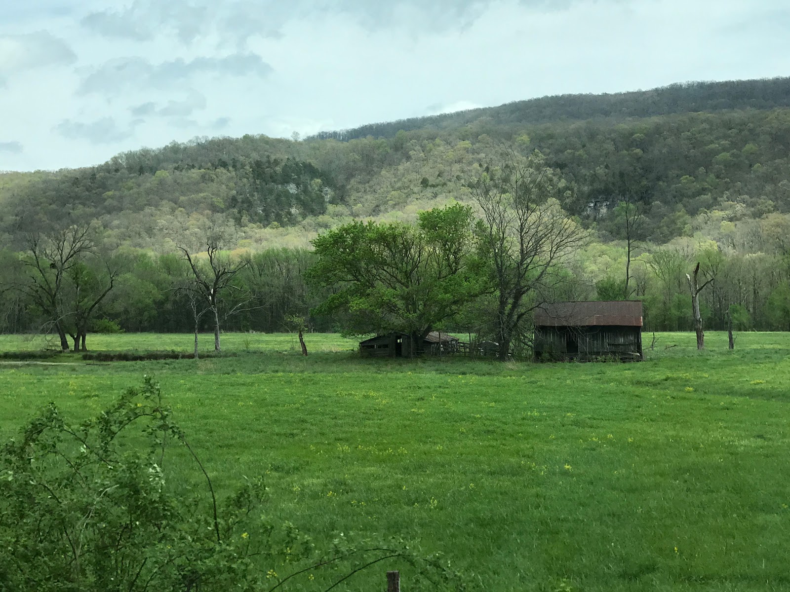
As we made the drive through Northern Arkansas and Missouri,
we were constantly struck by the lush, gorgeous aspect of the landscape and by
the distinctly rural flavor of the countryside passing us by. We have to wonder why we were so little
aware of this part of the country until now. Very beautiful to look at,
friendly people, affordable living, great fishing (and hunting too, if we were
interested). It seems like a wonderful area in which to vacation or to live.

It’s impossible to travel anywhere in the country without encountering evidence of the peoples who lived here for 10 or 20,000 years before we civilized folks arrived and slaughtered many of them, gave many more of them fatal diseases, made war on them, signed “treaties” with them, and eventually drove the few who still survived far away from their homes to “reservations.” Some of our journey through Arkansas and Missouri followed the Trail of Tears, along which members of the Cherokee Nation were forcibly removed to Oklahoma from parts of North Carolina, Tennessee, Georgia, and Alabama during the late1830’s.


It’s impossible to travel anywhere in the country without encountering evidence of the peoples who lived here for 10 or 20,000 years before we civilized folks arrived and slaughtered many of them, gave many more of them fatal diseases, made war on them, signed “treaties” with them, and eventually drove the few who still survived far away from their homes to “reservations.” Some of our journey through Arkansas and Missouri followed the Trail of Tears, along which members of the Cherokee Nation were forcibly removed to Oklahoma from parts of North Carolina, Tennessee, Georgia, and Alabama during the late1830’s.

On our journey we paused for a picnic lunch at the Mark
Twain National Forest near Doniphan, Missouri -- still in the Ozarks. It was another
terrific park – practically no one staying there at this time of year.
We discovered that Doniphan had an interesting Civil War
history. Missouri was a border state (a slave state that never declared
secession and never joined the Confederacy). In the Civil War, Missouri sent armies, generals, and supplies to
both opposing sides, had its
star on both flags, had separate governments claiming to be the legitimate
government of the state representing each side, and
endured a neighbor-against-neighbor intrastate war. As the
county seat of Ripley County, on the Arkansas border, Doniphan was caught in
this crossfire. Ripley County, a no-man’s land of sorts, was the site of ugly
guerrilla conflict. In 1864 Union forces invaded Doniphan, drove out
Confederate forces, and burned all but two buildings in the town. This invasion
became known to posterity as “The Burning of Donaphin.”
The peaceful picnic area where we ate our sandwiches may well
have been the site of bloody skirmishes.


The only visible signs of this history (to the eye of untethered
travelers such as we) were occasional Confederate flags flying above homes
along our route.


Arriving in Illinois, we camped at Wayne Fitzgerrell State
Park on Rend Lake, about 20 miles from where son Michael lives. Almost deserted (clearly this is a good
time of year to camp in state parks), it offered us our pick of nice campsites.
We picked one with a sweeping view of the lake. Sunsets follow us wherever we
go.


Actually it wasn’t quite that simple. OCD to the end, I had
reserved a campsite online. When we arrived at Fitzgerrell we found that the
“reservable” sites were the worst ones. Since virtually all the sites (reservable
or not) were vacant, we took our receipt off the space we’d reserved, found a
site we liked, and changed the site number on the receipt. When Ranger Chad
came around and heard our story, his brow furrowed.


After much complex negotiation, we worked it out. In the
process we found that Ranger Chad was one of three total staff for the entire
State Park. They used to have 12, but Chad made it clear that malfeasance in
the state government had resulted in the 75% cutback. Chad is not a fan of the
governor. Somewhat to my surprise
he’s not a Trump fan either. “I thought he had a few good ideas about trade,
but it turns out he’s just a politician like all the rest.”
Michael met us at the rig our first night in the area. Kate
made a delicious pork tenderloin dinner, and we got a chance to catch up.

During our stay we hosted a family barbecue at our campsite. Michael and family brought chairs, drinks, and chips and Kate and I provided the fire and the burgers.


During our stay we hosted a family barbecue at our campsite. Michael and family brought chairs, drinks, and chips and Kate and I provided the fire and the burgers.


Altogether there were 12 of us, including Michael and his wife
Candy’s family, and a few close friends.

Front Row, right to left: Candy’s son Luke, Luke’s daughter Kyra, Luke’s girlfriend (and Kyra’s mom) Brandi, Candy’s mother Violet, Michael, and Diaz (part of a family that lives with Michael and Candy). Back Row, left to right: Kate, Don, Candy, Candy’s ex James, Brandi’s dad Clifford.

Front Row, right to left: Candy’s son Luke, Luke’s daughter Kyra, Luke’s girlfriend (and Kyra’s mom) Brandi, Candy’s mother Violet, Michael, and Diaz (part of a family that lives with Michael and Candy). Back Row, left to right: Kate, Don, Candy, Candy’s ex James, Brandi’s dad Clifford.
We had a relaxed, enjoyable time, including some fishing from
shore and s’mores for dessert.


Ethan, Diaz's uncle (missing from the group photo because he was the photographer).


The next evening a smaller family group visited with us at
the campsite. We put together an array of leftovers for dinner, and got ready
to toast some marshmallows. Then the pestilential visitation began. An insect
invasion of Biblical proportions was unleashed upon us. A plague of mosquitoes,
June bugs, things that looked like flying centipedes, and smaller but very
numerous tiny flying animals surrounded us and began attaching themselves to
our food and to our clothing, and to fly and jump and leap onto our faces and
inside our ears, noses, and mouths.
The entire insect population of Illinois had emerged from hibernation
and hatched in a giant explosion of life in one evening – at our campsite. Someone
was heard to say, between gasps, “This is Armageddon.”
Kate attempts to hide from the bugs in the dark.
There was a fair amount of screeching and hopping around,
then a hasty retreat and departure of the guests. Kate and I cleaned up (while
doing a little hopping and screeching) and retired into the rig to kill
mosquitoes for an hour or so, using wet dishtowels as swatters.
This is just one of the reasons I’ve always so enjoyed
camping.
After our visit with Michael and family we returned to our
southerly route, this time following the Great River Road. The Great River Road
isn’t a road at all, but a series of twists and turns along lots of different
routes that, taken together, mostly follow along the Mississippi River. We
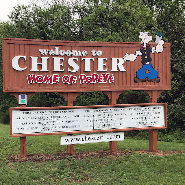
passed through Chester, Illinois, home of the first Illinois governor and -- seemingly
much more important to the chamber of commerce -- home town of Elzie Segar,
creator of the Popeye comic strip. Chester goes all out for Popeye.


We passed through Cape Girardeau, Missouri. In addition to
being the hometown of Rush Limbaugh, Cape Girardeau was one point at which
thousands of Native Americans crossed the Mississippi as they were herded from
their homes to Oklahoma along the Trail of Tears. The town has a levee more
than a mile long, to protect from Mississippi floodwaters. The Mississippi
drainage basin covers more than 40% of the continental U.S., and all that water
has resulted in many floods along its banks. The most devastating of the floods
was in 1927, when essentially the entire levee system along the river collapsed
in many places.


Cape Girardeau in 1927.

Kate on river side of the levee -- High water marks shown on levee.
Completed in 1964, the current levee wall in Cape Girardeau
has become the site of “Mississippi River Tales,” a series of murals depicting
the history of the area.


Just outside of Cape Girardeau is the Trail of Tears State
Park, where we camped on the Mississippi for the first time.


At the park information center we spoke at length with a very
informative ranger, who was a fount of information about the Trail of
Tears. We’d felt as if we were
constantly on or crossing the Trail of Tears for the past week or two; now we
learned why. There were nine separate routes taken from Georgia, Tennessee, and
North Carolina to Oklahoma by the various army detachments tasked with
escorting the Cherokees (and some other tribes) out of their homelands. Among the things I learned (having been
apparently monumentally ignorant beforehand) was that these were “civilized”
Indians, largely assimilated into Western ways, owning homes, growing crops,
employed in the economy of the towns where they lived. The “Indian Removal
Act,” championed by President Andrew Jackson, was a naked, racially-based land
grab designed to rob Native Americans of legitimate property ownership – not an
attempt to banish hostile savages.
Continuing on our meandering path into the South, we stopped
briefly at Fort Defiance in Southern Illinois, the site of the confluence of
the Mississippi and Ohio rivers.
It was another chance to confront our general ignorance of anything
between the west and east coasts. The Ohio River is huge. At the roiling
confluence, it appeared to us to be wider and more powerful than the
Mississippi that was absorbing it
There we saw a barge float down the Mississippi, make the turn and start a journey upstream on the Ohio. It too was huge.

There we saw a barge float down the Mississippi, make the turn and start a journey upstream on the Ohio. It too was huge.

Crossing into Kentucky, we paused a
while at the “Wickliffe Mounds,” the archeological site of an 800-year-old
Mississippian Indian village.


The Mississippian culture was
a mound-building Native American
civilization composed of a series of urban settlements and satellite villages
extending from the Great Lakes to Southern Appalachia. We saw an interesting
display of a “dig’ in progress, and of discovered artifacts.


Further south, we camped at the
Columbus-Belmont State Park in Columbus, Kentucky. [photo of camp sign] The
park is situated on a bluff overlooking the Mississippi; our campsite was
beautifully situated with a view of the river.


The town of Columbus (which of
course we’d never heard of) has a rich history. By the 1830’s it was one of the
busiest trading towns along the Mississippi, with a population of 3,000. The railroad crossed the river via
ferries at Columbus – 300 train cars a day.

Train ferrying from Columbus to Belmont in 1850's.

Train ferrying from Columbus to Belmont in 1850's.
Columbus became a stop on one of
the nine Trail of Tears routes in 1838 when nearly 1,100 Cherokees led by John
Benge crossed the Mississippi there on the way to Oklahoma. During the Civil
War, Columbus and its neighbor across the Mississippi Belmont, Missouri, were
strategically important to the Union and to the Confederacy. The Union wanted
to control the river to keep the Confederacy from using it to move troops and
supplies. The Confederacy wanted to thwart the Union’s attempts at control.
Though Kentucky and Missouri were nominally neutral, for a time the
Confederates controlled both Belmont and Columbus. In Columbus they built
fortifications including many miles of trenches nine feet deep and fifteen feet
wide (some of the trails in the state park utilized the remains of these
trenches).


In 1861 Ulysses Grant attempted to
take Belmont in his first Civil War battle as a general, but the Confederates prevailed. By
1862 and thereafter, the Union controlled both Belmont and Columbus. Columbus
became a major destination for escaped slaves hoping to get to the North. Eventually
Columbus was overwhelmed by escaped slaves; many of them were conscripted into
the Union army and formed one of the two Union garrisons housed at Columbus.


In 1927 Columbus became the first
entire town in Kentucky to be moved from one site to another. After the Great
Flood of 1927, it was moved from the banks of the river to the bluffs above,
where it now stands.


On a walk from our campsite, we
explored the town of Columbus, now a small community with a population of just
170. There are three public establishments in town: Jen’s Place, a restaurant
with six or so tables and an ambitious menu, the U.S. Post Office, and the Beards
and Roses General Store.


Jen's Place

Post Office.

Beards and Roses.
Jen, of Jen’s Place, is a single
mom with a 3-year-old boy who started her restaurant nine years ago. She does
all the food shopping once a week at Sam’s Club and Walmart (20+ miles away),
and does all the baking and most of the cooking herself.

[Author's note: While leaving the parking lot of Jen's Place, I backed the rig into a cleverly disguised (but deep) ditch. By the time I had managed to extract the rig from the ditch, the casement for the sewer hose (replaced in its entirety four months before) had been damaged. It seemed to be still functional. Be alert for more on this topic in later posts.]
We stopped at Beards and Roses just for a moment to see what was there, and ended up staying for two hours, until closing time drove us out. The proprietors of Beards and Roses are Robb and his wife Rose.

Robb is from Detroit, and Rose was
born in Southern California. Both
have deep roots in Columbus. Rose’s family moved back to Kentucky when she was
just one year old, and she’s lived in Columbus since then. Robb worked in
Detroit until by chance he met Rose twenty years ago, and he followed her here.
Robb had worked mostly factory jobs during his working life (e.g., in a company
producing hams and in a factory assembling Remington rifles). Rob lost his most recent job recently
when Remington relocated its factory. About a month before we arrived, Robb and
Rose finished renovating the long-closed general store in Columbus and
re-opened it. They’re starting slowly, with a small but growing inventory of
staples and two specialties: home-made pizza prepared by Robb and home-made
baked goods prepared by Rose (Rose also has a day job in a pharmacy in nearby
Clinton, Kentucky).

We got to talking with Robb, Rose,
and cousin Toni, who was there as a customer. It was such a pleasant
experience, and they were such warm and friendly people, we found we couldn’t
seem to leave. We can now vouch for the fact that Robb’s pizza is out of this
world (our dinner that night), and Rose’s baked goods are wonderful (dessert).
We’re rooting for their success; all they need is a potbelly stove and a
cracker barrel, and we’re sure they can become a major social center in the
region.
Our camp host in Columbus was
James.


James and Kate.
James and his wife live in
Tennessee; he told us he’s had a good life. He worked in a penitentiary in
Tennessee for 22 years. He told us
and his wife have been married for nearly 50 years, and they’ve had their rough
patches, especially when he was young and drinking heavily. “Those bridges
across the Mississippi are way too narrow. I used to drive them all the time,
but I was always drunk. One time I drove sober, and I said ‘That’s the last
time I ever cross that river.’”

About his years working at the
penitentiary, James shared: “Every month we’d have to go to Tullahoma for a
couple of days [for continuing education classes] so people could act stupid.
One guy went to a motel with a woman we worked with. Someone saw them, and
called his wife. She called the motel and they said, ‘Yes, he’s registered,’ so
she called his room. He answered the phone!” James said he would never cheat,
but “If you’re going to go to a motel with a woman, park your truck around back
and don’t answer the phone!”
James shared other good insights
with us. His grandson was being bullied by someone at work. His advice: “If you
want to fight with someone, go up to him while he’s in his car, pull his head
out the window, and beat on him. Nothing he can do.”
Leaving Columbus and heading toward
Memphis, we stopped briefly in Henning, Tennessee to take a look at the Alex
Haley State Historic Site and Interpretive Center.


The center consists of the house
where Haley grew up (built by his grandfather) and an impressive brick, steel,
and glass building housing historical information, including exhibits featuring
Haley’s masterwork, “Roots.”


Henning itself has the feel of a
town that hasn’t changed much since Haley lived there as a young boy in the
1920’s and 1930’s – except that time hasn’t been kind to the town; it seems
poor and is deteriorating. There are still chickens and roosters running free
in the yard across the street from the home, and some of the nearby houses look
like they may have been there in the 1920’s (but are now abandoned). [


Next stop: Memphis.


Miles to date: 15,229
States: California, Oregon, Washington, Montana, Idaho, Arizona, New Mexico, Texas, Arkansas, Missouri, Illinois, Kentucky, Tennessee (13)
Countries: U.S.A., Canada, Mexico (3)